British Columbia

Cummins Fire Lookout

Cummins Fire Lookout

Updated March 25, 2023 - Published March 25, 2023

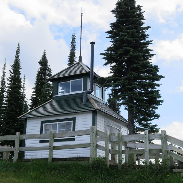
North of Revelstoke and west of Cummins Lakes Provincial Park, this former BC Fire Lookout can be accessed off a branch of the Wood River Forest Service Road, which in turn is accessed by boat ride across Kinbasket Lake. From the road, it is a 5.5 km (3.4 mi) one-way hike along an overgrown lookout tower service road to the top. Expect an elevation gain of 1,060 m (5,250 ft) from the road, or 1,600 m (5,250 ft) in total.

Access notes

  • Backcountry
  • Boat
  • Off-road
  • Off-trail
  • Public

References

Contributors

  • BRMB Maps

Comments

Cummins Fire Lookout

Coordinates

  • 52.10586, -118.29685

Province

British Columbia

Build date

Unknown

Status

Non-active

Elevation

2367.1 metres

Tower type

D-6

Tower height

Unknown

Operator

BCFS

Date added

March 25, 2023

Related lookouts

Columbia-Shuswap, BC

0km

Columbia-Shuswap, BC, Canada
100km
Nearby

Copyright © 2024, Firelookout.ca. All rights reserved. Contributed material may be separately copyrighted.

Last updated 2023-03-25 02:07:31